India is going through a lot of turbulences be it with the rising number of COVID-19 cases or the tensions along the LAC and its faceoff with China or the faceoff with militants in several areas of Kashmir or the differences with Nepal with respect to the New map which announced by the Nepal Parliament. In this article, we will try to know the exact information regarding the Indo- Nepal borders, and also, we will give you our Vishleshan on this row and how these differences can be resolved.

pic: iasparliment
Historically, India and Nepal share a brotherly relation. Both countries share a special relationship in terms of trade and tourism. You need not require any passport or visa to visit Nepal. Indians who live along the border of Nepal enjoy the facility of trading in Nepal without any levy imposed on them. Despite these friendly relations and mutual understandings, India always had border issues with Nepal.
India shares a 1751 km land border with Nepal spread across Uttarakhand, Uttar Pradesh, Bihar, Sikkim, and West Bengal. Major Border Disputes are in the regions of Kalapani (Pithoragh dt. , Uttarakhand) and Susta (Bihar). These disputes are due to the Sugali Treaty which was signed by Nepal and India (under British) in 1816. According to this treaty, the land Origin of the Kalapani river is identified as the boundary. The problem is that the Kali river has multiple tributaries. India claims that the origin of the Kali river comes under Indian mass whereas Nepal differs and says that the river originates at their landmass and hence claims the subsequent Kalapani area as a part of its territory.
What prompted Nepal in Releasing a new map?
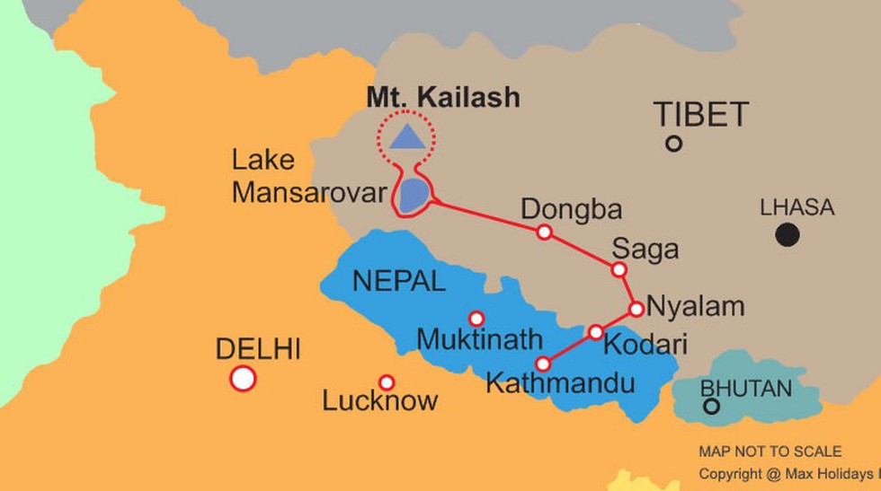
This Kalapani region is crucial because the Kailash Manasarovar Yatra which takes place every year where thousands of Indian Pilgrims travel to Mansarovar in China becomes easy for the Indians if they use Kalapani to reach Manasarovar. Regarding, this India is building a road until Lipulekh pass (which happens to be the Indian border with Nepal and China) and will be the shortest and easiest route to Mansarovar. But Nepal opposes this project as it claims Kalapani as the land under their control. This Recent advancement by India propelled Nepal to Pass a bill in their parliament, releasing a new map that shows the disputed region as their territory.
What is the way forward?
Over the years, there have been several negotiations between both sides to resolve this dispute, like the committees formed by either side in 1990 and most notably the meet of foreign secretaries in 2014. But, all of them failed to yield a solution. India should make it's firm stronger in its argument. However, it should also keep in mind the Special relationship with Nepal in which both countries enjoy significant benefits. Since the meeting of lower rank diplomats failed to find a solution, it is time for the higher rank officials to try and negotiate terms. India should follow the strategy which it pursued during the dispute with Bangladesh where it formulated a Land Border agreement and maritime agreement. Although in both cases, India had to lose its stake, those agreements worked in favor of having a cordial relationship with Bangladesh. With the danger of the Dragon always around the corner, India could not afford a rivalry with Nepal.
Abhishek Reddy
Please subscribe to get our latest articles to your mail.
Follow us on Instagram
Comments
Post a Comment